
Geospatial Survey
Accurate Spatial Data for Every Project
Get a Free Quote From Us Today!
We aim to get back to you in 24 hours.
At Geospatial Survey, we provide expert geospatial surveying and data collection services tailored for land, property, and construction projects. We capture precise spatial information that supports mapping, design, planning, development, and asset management requirements.
Our specialised techniques and equipment ensure that every detail is accurately recorded to meet our clients’ project needs across the UK. Contact us today to discuss your surveying requirements.
Who Is Geospatial Survey?
We’re Geospatial Survey, and we specialise in providing professional geospatial surveying and data collection services. Our skilled team captures comprehensive spatial information using the latest surveying technologies.
We deploy advanced techniques like LiDAR, 3D laser scanning, and UAV (Unmanned Aerial Vehicle) photogrammetry to ensure precise data collection. Our team is experienced in creating topographic surveys and boundary surveys that meet industry standards such as RICS and OSGB36.
We support a wide range of projects, including land development, construction, and property management across the UK. Our services extend to infrastructure mapping and environmental monitoring. We work with architects, civil engineers, environmental consultants and government agencies to deliver accurate and detailed reports.
Our goal is to provide reliable data that informs critical decision-making. For precise geospatial data solutions, trust Geospatial Survey to support your next project.
What Geospatial Surveying Services Does the company Geospatial Survey Provide?
At Geospatial Survey, we provide a range of specialised geospatial surveying services to cater to various project needs. Our core services include:
- Topographic Surveys: Capture detailed terrain data for planning and design. We employ technologies like GPS and Total Stations to ensure measurements meet the necessary accuracy standards for civil engineering projects.
- Boundary Surveys: Precise identification of property lines and boundaries, often required for legal documentation and property development. Our surveys are compliant with the relevant Land Registry requirements.
- As-Built Surveys: Accurate representation of completed structures for documentation. We apply techniques such as photogrammetry to verify that constructions meet original design specifications.
- 3D Laser Scanning: High-resolution data collection for detailed analysis and modeling. Ideal for historical building conservation, we use equipment such as Faro and Leica scanners for detailed point cloud data.
- Satellite Imagery Analysis: Use of remote sensing data for comprehensive area assessments. Our analysis supports environmental monitoring, leveraging multispectral and hyperspectral imaging to detect changes over time.
Our team is ready to provide expert support for your next project with precision and detail.
When Is Geospatial Survey Needed?
Geospatial surveying from Geospatial Survey is essential in various scenarios. Our services are needed during planning and development stages to gather detailed spatial data using techniques such as aerial photogrammetry and LiDAR scanning.
We assist when defining property boundaries is crucial for legal purposes, following standards like the Land Registration Act. Accurate mapping is required for infrastructure projects such as road and railway construction, where GPS equipment and total stations provide precise coordinates.
Our data collection supports efficient asset management, using Geographic Information Systems (GIS) to integrate data with existing management platforms for utility companies and municipalities. Maintenance planning is enhanced through our services, often used during construction phases and post-completion evaluations to ensure compliance with construction codes and environmental regulations.
Contact us to learn how our geospatial expertise can support your project.
Get a Free No Obligation Quotation Today
How Does Geospatial Survey Work?
Here’s a brief overview of our geospatial survey process:
- Consultation: We discuss project requirements with clients to establish objectives and identify spatial challenges specific to the site, such as elevation variations or site access constraints.
- Planning: A tailored survey plan is developed, incorporating project specifications as well as compliance with standards like ISO 19113 for geographic information quality. Scheduling is aligned with client deadlines and resource availability.
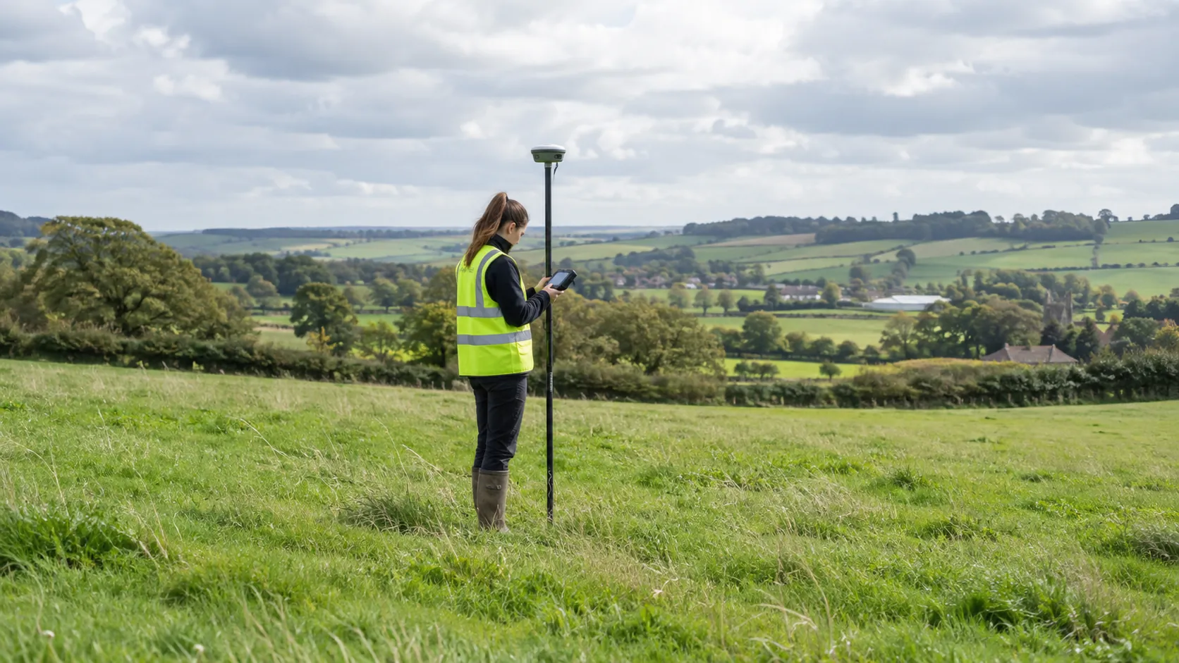
- Data Collection: Our team uses instruments like the Trimble R10 GNSS Receiver and Leica Total Stations for precise data capture, ensuring spatial accuracy. We adhere to vertical and horizontal accuracy standards suitable for both small-scale and large-scale projects.
- Analysis: We process and analyse the spatial data using GIS software such as ArcGIS and AutoCAD Civil 3D to deliver comprehensive insights that support decision-making in urban planning, construction, or environmental management.
- Report Delivery: Clients receive detailed reports and data outputs formatted to industry standards, ready for project integration and enhancing strategic planning efforts.
Our process ensures each client’s unique needs are met with precision and efficiency. Contact us to learn how we can support your next project.
Who Does Geospatial Survey Help?
Geospatial Survey serves a diverse clientele across various sectors. We assist architects and designers by providing highly accurate topographic and measured building surveys, crucial for creating precise plans and layouts.
For construction companies, our laser scanning services deliver detailed site data that enhance project planning and risk mitigation. Developers rely on us for Geographic Information System (GIS) solutions to inform decision-making and streamline the planning process.
Our services also benefit estate managers, who use our data for comprehensive asset management and strategic development. Local authorities depend on our aerial mapping and photogrammetry techniques to obtain reliable spatial data for infrastructure projects and urban planning.
Property investors and energy companies also use our land survey services to assess site potential and environmental constraints. Whatever your needs, we’re here to support your projects with reliable geospatial solutions.
How Quickly Can Geospatial Survey Respond?
At Geospatial Survey, we understand the importance of timely responses, particularly in industries where project deadlines are critical. Typically, we respond to enquiries within 24 hours to discuss project specifics and scheduling.
With our team of experienced professionals, we ensure that our services align with project timelines, providing efficient and reliable data collection and analysis. We employ advanced surveying methods such as LiDAR scanning and photogrammetry, which offer precise measurements and three-dimensional data useful for construction, urban planning, and environmental monitoring.
Our fleet includes UAVs (unmanned aerial vehicles) equipped with high-resolution cameras to capture and process large areas swiftly, aiding projects that require rapid updates. Whether for commercial developers or environmental agencies, our quick response and specialised technology help maintain smooth project operations.
Let us support your ongoing and upcoming projects with our timely and precise geospatial data solutions.
How Does Geospatial Survey Ensure Quality and Compliance?
Quality and compliance are at the heart of our operations at Geospatial Survey. We adhere to industry standards such as ISO 9001 and ISO 14001, ensuring environmental and quality management excellence in our work.
Our team is equipped with advanced GNSS (Global Navigation Satellite System) equipment, total stations, and LiDAR technology to ensure precision in every project. We employ rigorous data validation processes, cross-referencing geospatial data with authoritative sources to maximise accuracy.
Our commitment to these practices supports compliance with relevant planning and development regulations, including securing accurate topographical and boundary surveys.
We also routinely conduct internal audits and training to keep our team updated on the latest regulatory changes and technological advancements. These measures are crucial for effectively supporting a diverse client base, from architects and planners to construction companies and government bodies.
Whatever your geospatial needs, we ensure accuracy and reliability every step of the way.
Request a free quote
Why Choose Geospatial Survey?
Choosing Geospatial Survey means selecting precision and expertise backed by a range of surveying capabilities. Our benefits include:
- State-of-the-Art Equipment: We employ cutting-edge tools like LiDAR scanners and UAVs (unmanned aerial vehicles) to gather high-resolution data efficiently, ensuring accuracy in every measurement.
- Experienced Professionals: Our team is proficient in numerous surveying techniques, including hydrographic, topographic, and 3D laser scanning methods, enabling us to support varied projects from construction to environmental monitoring.
- Comprehensive Data Outputs: We provide detailed reports that incorporate GIS (Geographical Information System) mapping and 3D modelling, facilitating informed decision-making throughout multiple project phases, including planning, design, and execution.
- Nationwide Coverage: Our operations span across the UK, maintaining consistent quality of service whether the project is in a rural area or an urban centre, ensuring accessibility and reliability for clients in any location.
We are dedicated to delivering precise data and reliable service across all project types.
Frequently Asked Questions
What technologies does Geospatial Survey use?
We employ technologies such as 3D laser scanning and GPS to capture precise spatial data, ensuring results for all surveying needs.
How accurate are your surveys?
Our surveys deliver precision, typically achieving accuracy within centimetres, meeting the demands of engineering and architectural applications.
How do I get a quote for a survey?
Simply contact us with your project details. We will assess your requirements and provide a detailed, no-obligation quote tailored to your needs.
Can you provide reports in different formats?
Yes, we can deliver reports in various formats, including CAD drawings and GIS databases, to integrate with your project requirements.
Do you offer consultancy services?
Yes, Geospatial Survey offers consultancy to help clients optimise surveying strategies and maximise the value of their spatial data.
Get a Free Quote
Take the first step towards precise spatial data with Geospatial Survey.
speak with our team today
What People are Saying About Us
★★★★★
“The data from Geospatial Survey came through quickly and looked really good. Very happy with it, and it was easy to load straight into our software.”
Megan Jennings
London
★★★★★
“We needed reliable site data for a land development. Geospatial Survey delivered it on time, so our design team could move ahead with confidence.”
Thomas Okafor
London
★★★★★
“We needed a point cloud and drawings our engineers could use straight away. Geospatial Survey labelled everything clearly, which saved us time on the next stage. Highly recommended.”
Rebecca Okafor
London
★★★★★
“Accurate, well-organised survey data from Geospatial Survey. Friendly, professional and thorough throughout the whole job.”
Priya Pritchard
London
Our Locations
We are proud to work nationally across the UK, allowing us to ensure we can provide services to you.
For a full list of counties we cover in the UK, see below.